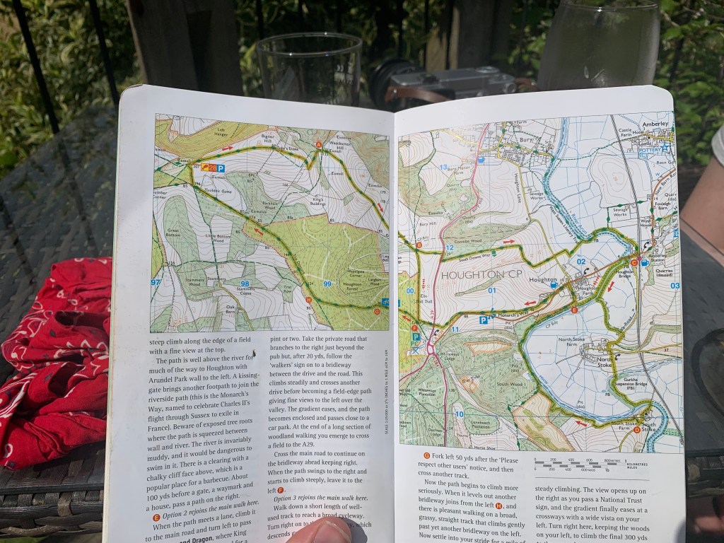
Time for another of our further-afield adventures, this time really pushing the envelope, by delving all the way into West Sussex – a whole county further along than normal. The occasion occurred because the following day we were due to be going to the Goodwood Festival of Speed; my 30th birthday present from Beth. As we wanted to get there for gates opening at 7am, we had decided to stay close by the night before, and so ended up making a whole weekend of it. We arrived at our Air B&B, The Pump House, Friday night, and enjoyed a well-earned lay-in Saturday morning, before making the day’s plans. We knew that we wanted to go for a walk (obviously) and felt that as we were in an area we didn’t usually visit, we ought really to make the most of it, and go for one of our longer ones available. Not knowing the area, we didn’t really know where to aim for but fortunately, this was not an issue, as The Pump House came equipped with a handy OS guide full of local walks. Flicking straight to the longer walks at the back, we finally settled on the last (and the longest) walk in the book, which seemed to offer the biggest variation in scenery and environments, hopefully meaning we would be able to get much of the South Downs National Park experience in one day.
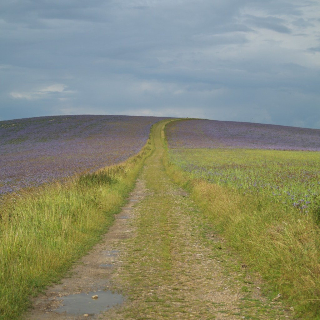
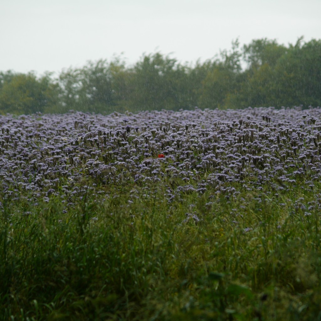
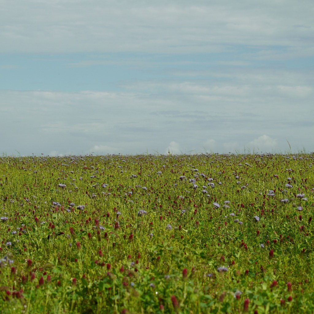
Our extended lay-in and leisurely breakfast did mean a late start, not arriving at our starting point near the top of Bignor Hill until about 11.30am. Here, we were immediately greeted by a stunning view across miles of countryside below, before setting off along an upward-sloping track toward the summit itself. Only moments later, beautiful pasture opened up across the hilltop to our right, filled with an array of reds, yellows, whites and purples, causing us to literally stop and gasp. Ahead, we walked steadily toward and soon through the middle of a blanket of purple flowers which had engulfed the peak, before we reached the edge of the meadow, where we were once again rewarded with views across the Downs. Here, we began to descend until we reached a crossroad of footpaths. We took the right fork past a barn and walked along a track running mostly levelly along the side of the next Down, through meadows and pastures to either side. Since setting off, a dark cloud had loomed in the large sky overhead, and finally began to sprinkle a little on us at this point, although it barely counted as rain. The path began to descend after a mile and we found ourselves standing at the edge of a busy road. The visibility wasn’t great, so after a little patience, we made a quick dash across to the other side.
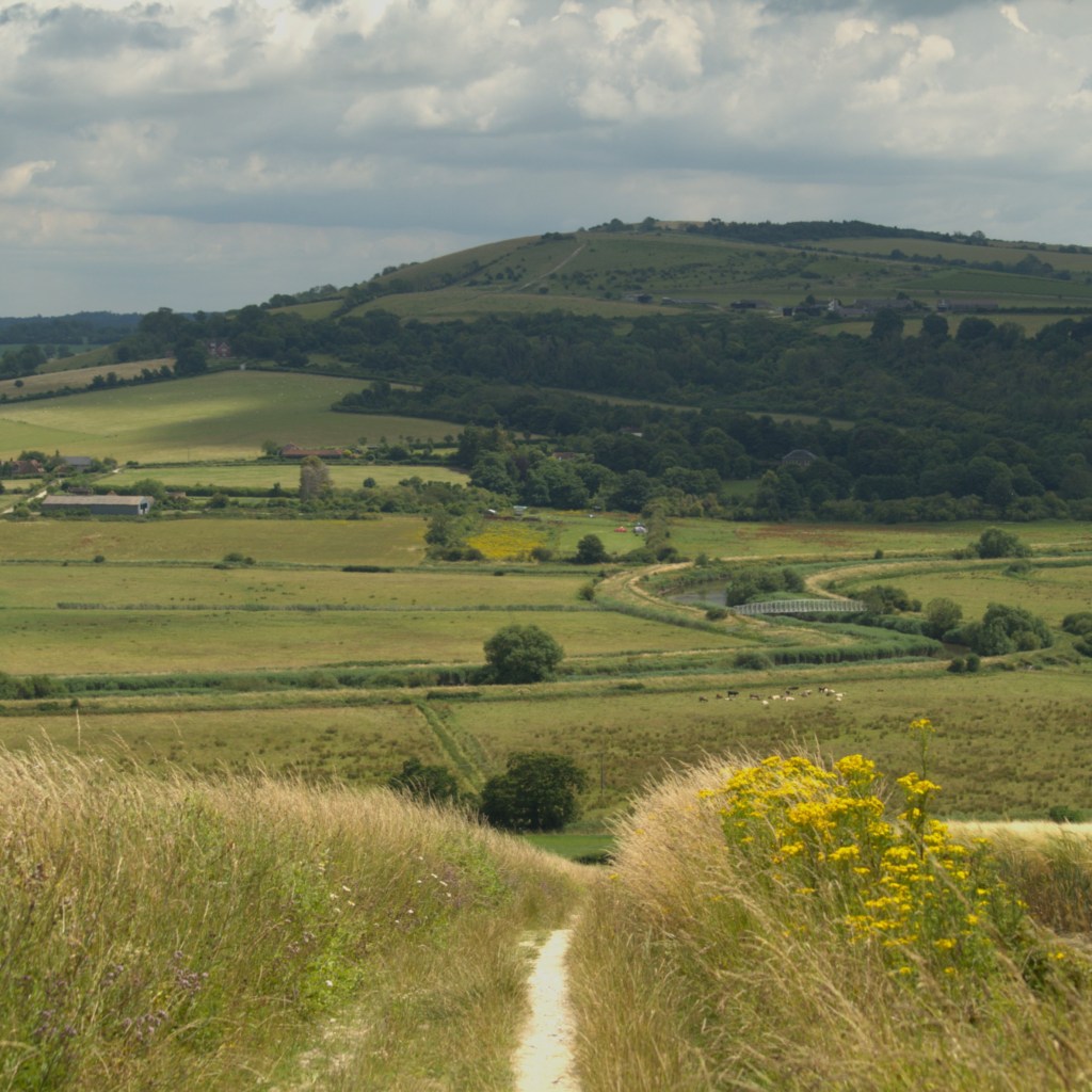
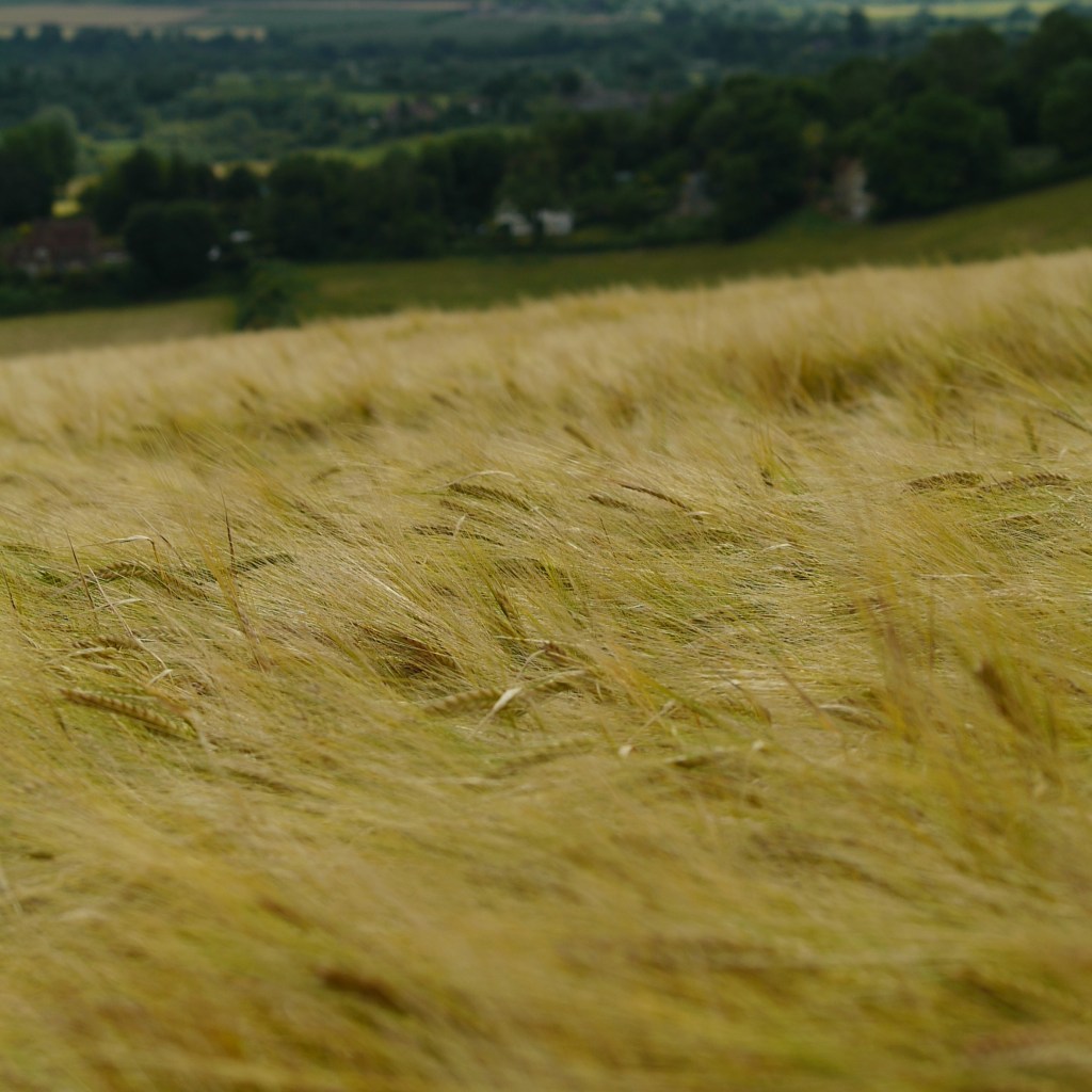
The drizzle eased and the gloomy cloud went elsewhere, leaving us suddenly with sunshine and clear blue skies. We walked along a gradually descending footpath between great fields of gently rippling golden wheat, with a great view of the world below us, toward which we were headed. As things began to level out again, we found ourselves walking into a field containing a herd of cows huddled together in the middle. We had spied these from our high vantage on the hill a few minutes before, and had hoped we wouldn’t be walking through, but naturally this wasn’t the case. We were quickly reassured however by the presence of a sturdy-looking electric fence marking the edge of the path, and they barely reacted to our presence, so no issues today. After this encounter, we arrived at the edge of the River Arun, which would make up the next portion of the walk. Making our way across a metal bridge to the opposite bank, we came across a man walking his pony, so we paused to say hello (to the horse, not the human). After finally leaving the South Down’s Way, we wandered a little away from the river and found ourselves walking along a busy road through a small village. Halfway across a second bridge, a footpath appeared and so we were able to duck back down and re-join the river, seeing a yellow Lamborghini driving along the road next to us a few minutes later – nice. However, we weren’t walking along the bank for long until the path again took a sharp turn away from the water. The guide booked said that this stretch was often overgrown, and to be fair, it wasn’t lying. For much of the next ten or so minutes, we were hunched over and ducking out the way, doing our best to avoid thorns, roses and nettles, and detaching ourselves whenever we failed. We were eventually spewed out of the undergrowth, for once glad to again feel tarmac beneath our boots.
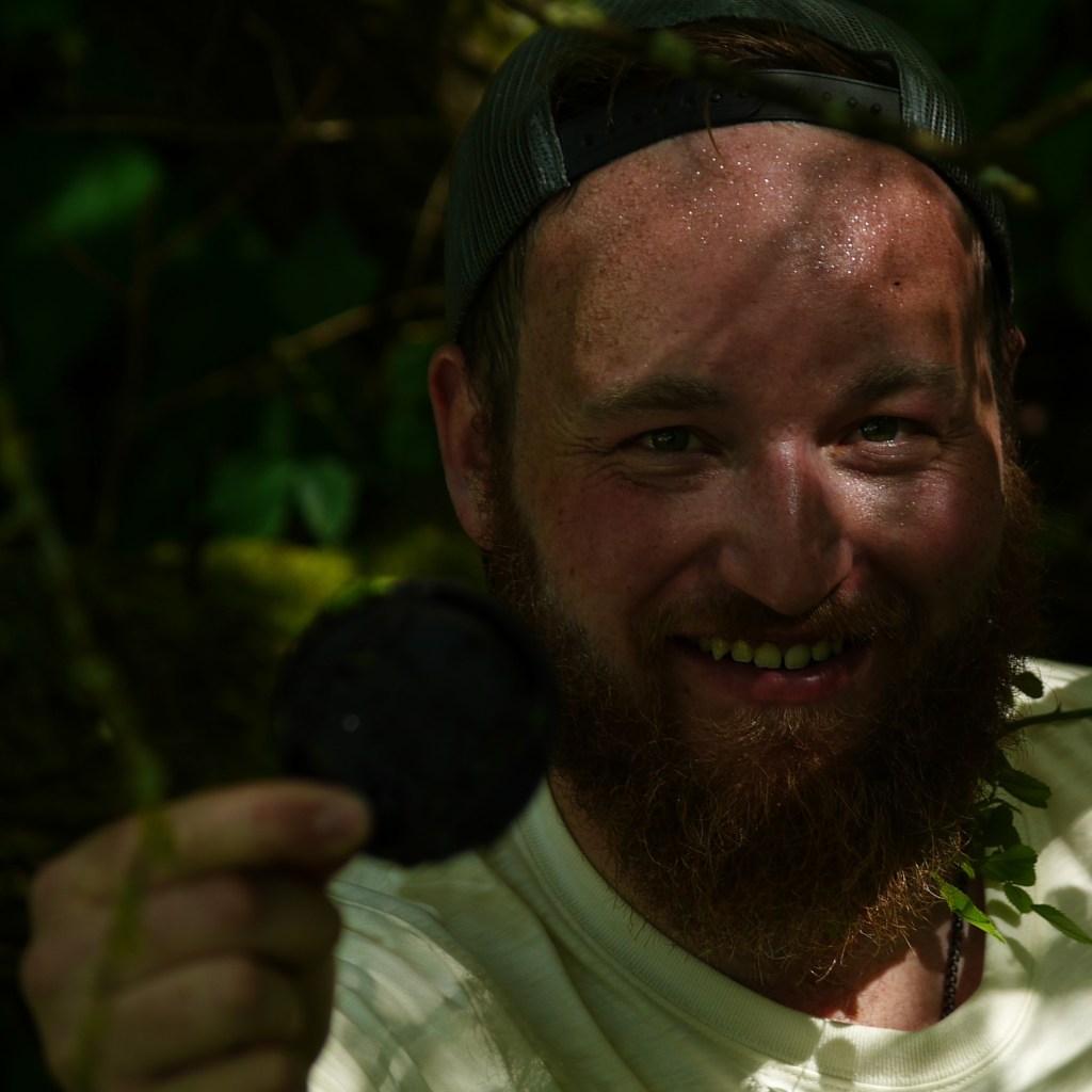
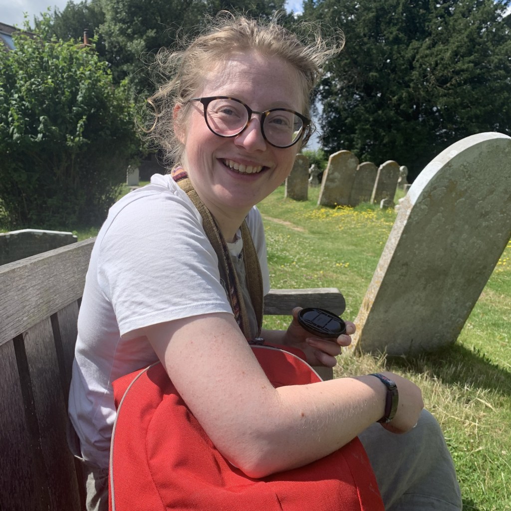
We walked up the steep road for a couple of minutes before the promised footpath appeared near a red phone box, where we dove back into the countryside. We were soon faced with another cow field to cross, only this time there was no protective wire and cattle to either side of the path. Unusually for the south, the cows in question were Highlands, a mixture of orange and black, and all with those great, distinctive horns. Again however, they barely batted an eyelid as we passed them by without incident. The path disappeared amongst undergrowth once more, but a minute later emerged onto an intriguing-looking suspension bridge, over a former meander of the river, which had now been blanketed with floating green duckweed. The bridge had been reconstructed some years previously by the Gurkhas, and with its wild surroundings and accompanying dangling branches, felt almost jungle-like. This inspired Beth to try and capture the scene with her camera. As I walked ahead across the bridge I heard a sudden gasp, the sound of something going plop into the water and a sharp “oh-no”, from Beth. Turning round to see what had happened, I was greeted with the sight of a wide-eyed fiancée, and a dark hole amongst the water’s green covering. After taking her photo, she had been putting her lens cap back on, which had slipped from her hand, clattered down onto the bridge and tumbled into the awaiting water below. Upon inspection, we noticed that the cap was actually still just about visible, possibly caught by something below preventing it from being fully submerged. Deciding to be the hero, I launched a daring rescue mission. After unloading my phone and bag to Beth safely across the bridge, I began to carefully make my way down through the thick, spikey overgrown undergrowth next to the bridge toward the stagnant water. Along the way, I grabbed a handy-looking stick which had fortunately been placed in my path by some higher power. After making it through the treacherous foliage, I found I had managed to get close to the squidgy edge of the water. Lowering myself cautiously down, acutely aware of the possibility of falling in myself, I reached across with my new fishing rod and gave the cap a cautious prod. It was at this juncture, that I discovered crucial information – the lens cap floats! Hope suddenly soared, and I began to carefully nudge it slowly back toward the shore across the water. This turned out to not actually be as simple as it sounded, the cap regularly disappearing beneath the blanket of green, completely vanishing from sight for long stretches. After a few minutes of careful swishing of the water, the lens cap appeared bobbing just close enough for me to reach out and grab it. Triumphantly, I stood up and raised the cap above my head in the ultimate moment of victory – I enjoyed this side quest far, too much. After pulling myself back up onto the bridge and returning the cap to its grateful owner, we continued on our way and soon found ourselves back beside the river itself, although it was completely obscured by the continuing thick undergrowth on our right until it eventually reappeared as we approached another bridge. Over the other side, we ascended a steep stone track, at the top of which was a quiet old church, where we stopped for a late lunch. The day had grown hot since we started, but the bright and peaceful graveyard offered a sunny bench directly in the path of a cool breeze, so was the perfect spot.
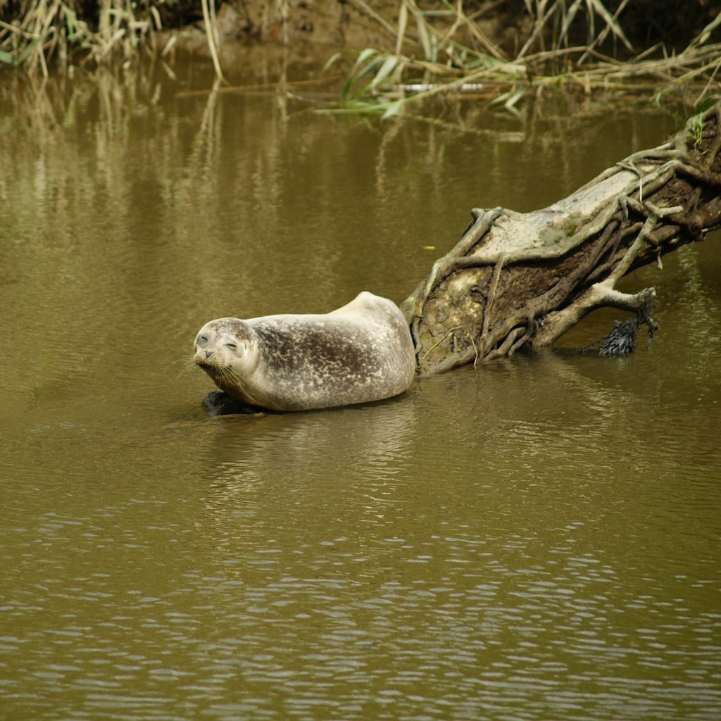
Food eaten, we made our way through a farmyard and back onto a footpath which had views of sweeping farmland to our left, and the river trundling somewhere below us to our right. Unfortunately the undergrowth continued to be very dense, so we didn’t really get to enjoy much of the river, however it did have one particularly fantastic treat in store for us. After descending back down to water level, the foliage finally opened up to give us a rare view of the sunny river beyond. And what should we see waiting for us? An adorable, chubby, seal, sunbathing on a perfectly positioned log protruding out across the river. This was definitely a first for us and certainly not something we had expected to see when we had set off that morning, and the seal earned itself a few minutes of oohing and ahhhing as we stared appreciatively at the dozy animal. After a little bit longer walking past the hidden river, our path took us away from the water for the final time, as our route turned ominously back toward the start line, which waited somewhere far uphill. We hadn’t been climbing long before we found ourselves walking past the George and Dragon pub – an old and very pretty-looking establishment. After debating on whether to stop for a quick drink (the afternoon was getting on by now) or not, during which time we were passed by a red Ferrari (nice), we eventually relented and made our way inside. A few minutes later, sitting in the garden on their raised balcony overlooking the wheat fields through which we had walked earlier in the day, we sipped at a pint of Coke and Orchard Thieves, feeling pleased with our decision. As I enjoyed my tasty, cool cider, Beth suddenly announced ominously that we were about to get soaked. Sliding her phone with its open weather app toward me, I saw what she meant. It was at that moment I spotted the large, dark cloud appearing above the hill ahead. Nodding to myself, I quietly continued to sip away at my pint in dignified resignation.
Quick drinks drunk, we left the comfort of the pub to the immediate ascent of the climb, anticipating the imminent downpour. The predicted rain did arrive a few minutes later, although to begin with was more of a shower, during which time we were largely sheltered by trees and stayed pretty dry. Crossing back across the busy road, we walked along the edge of one of the pretty meadows from earlier in the day. At a footpath junction, I chose the right way, which was in fact the wrong way and we briefly found ourselves attempting to walk up a desperately overgrown path, only giving up when faced with a wall of towering nettles. Turning back, we were able to ask a well-timed local for guidance, which confirmed that the left path was indeed the correct choice. Arriving on the wide track that would lead us through the day’s large stretch of woodland, we compared wounds as the rain eased for a time: I definitely won this contest, with blood trickling down both shins. We carried on along the path through the trees as we continued to slowly climb, knowing that the end was not far now. As we approached the edge of the woodland, the skies naturally decided it was time to unleash its final downpour. The trees fell away in front of us and showed heavy rain falling on the purple meadow ahead. Donning our jumpers for the final push, we boldly stepped out into the world beyond. To our right, the purple gave way to a pasture on which livestock grazed. Now, explain this to me:
“Sheep,” I called back to Beth.
“Sheep?” she asked.
“Sheep,” I confirmed.
“Geese,” she concluded.
Baffling, never mind the fact that sheep and geese look somewhat different, even to the untrained eye.
We made our way past the sheep-geese, and the view opened up to our left, as our path took a fork to the right, with our final slope back up to the car park. We finally returned to the stunning views that had started our day, just as the rains ceased and brilliant sunshine poured forth from a clear sky once more – the perfect ending.
Following a final admiration of the colourful world hidden on the hilltop, we climbed back in the car and trundled back down the hill toward our accommodation. I am glad we picked this walk and feel that it did deliver on giving us a good picture of the area, although a few more clear river stretches would have been nice – but this can’t be helped! I would definitely suggest making sure you leave plenty of time to stop in the George and Dragon as it was a really cool little pub – in fact if you didn’t want to walk all of the river section, you could easily cut straight to the pub and still have yourself a decent 8-mile walk. Considering that the walk is draped over the downs and the final third of the day is essentially all uphill, it was actually surprisingly easy, and at no point did we feel strained, often hardly noticing that we were climbing. The real unexpected jewel I would say would be the meadows at the top of Bignor Hill at the start/finish line, so even if you don’t do the walk, do go and visit the hilltop if you are in the area on a sunny summer’s day.
After an enjoyable and tiring day, we soon found ourselves waking up at 5am the next morning to make sure we were at the Festival of Speed as soon as it opened, where we had an awesome time and I made Beth climb the somewhat more famous (although significantly smaller) Goodwood Hill – a perfect weekend!

It is indeed a fine walk. I believe it’s a hop garden not a field……more Kentish don’t you think?
LikeLike