


It’s fair to say that the starting point for the day’s adventure, Crowborough Station, was very possibly our least desirable to date. The town is much, much larger than most of the villages we base our walks around, and came with all of the wonders of the modern world; smashed glass, industrial estates and assorted rubbish. The station’s only saving grace was the wafting smell of warm doughnuts on the air, however by the time we had argued with the station’s parking system which involved battling a clunky website, even that had faded. We knew this would be the case, having looked at the map, and was the reason why we had not done this walk before now. Yet we also knew the countryside awaited, and so we optimistically set off.
A little down the road from the station, we spotted amongst the urban dreariness, a beacon of hope; the familiar, comforting site of a way marker, directing us up a rising pathway. For a while, a trickling stream ran alongside us, which seemed completely at odds with its surroundings. This continued between the aforementioned industrial estate to our left and houses to our right and was a particularly steep start to the day which caught us by surprise. We made our way across the town, crossing another road, taking another byway and then making our way back up to the main road (this first section was really designed to keep any walkers away from the busiest of Crowborough’s roads – fair enough.) We crossed over and picked up a long concrete driveway by a newish-looking estate. After this, we came to ‘Walsh Manor’, shortly after which Beth described our surroundings as feeling a bit ‘murdery’.
Things then began to get a bit better as we continued to follow the firm track uphill and slowly out into more country-esque surroundings. I say more country-esque, we did pass a woodyard busy with heavy machinery on Crowborough’s outskirts, before the route brought us to Hadlow Down Road. Whilst this was a more familiar country road setting, it turned out to be quite a fast one, if not overly busy. We were also on it for quite a while, although we did manage to hear a few birds singing as we went, and the sun attempted to burn through the grey sky, a pale white disc glowing faintly above.
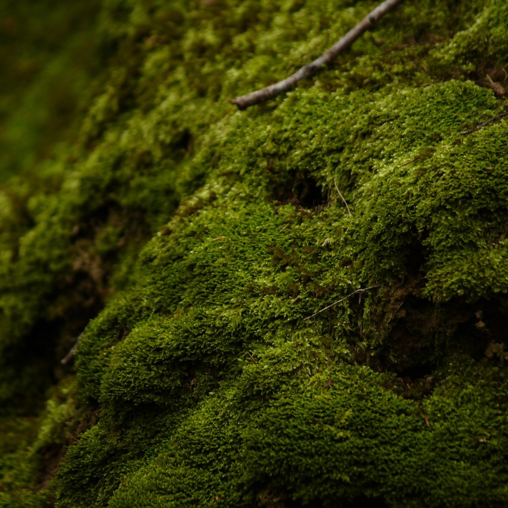
Eventually, we turned left and slowly descended down another stoney byway, and here we finally felt immersed in nature. This next section included some of the finest mosses we have ever seen. Multiple different shades climbed over exposed roots of the surrounding trees, pocked with many small holes, so that the woodland looked to be inhabited by a thriving community of fairies. As the path began to rise again, we heard suddenly the loud tumbling of water, and found on a corner a small, but crashing waterfall, underlining the magical feeling. We continued upward, and we waved goodbye to the fairies as we left the fantastic moss behind us.
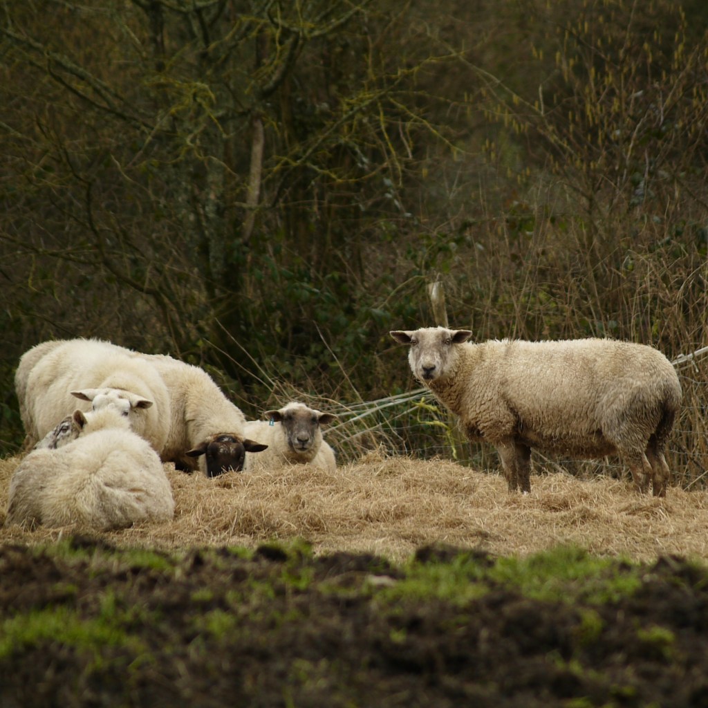
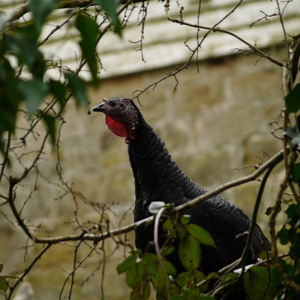
The route eventually brought us out to another road, ominously called “Steep Road”. It also promised to be a whole mile until our next footpath, however it turned out to be a very quiet lane, and was actually one of the day’s most scenic stretches. It wasn’t long before we spotted a few deer across a field (fourth walk in a row for those counting) and some sheep munching at some fresh hay shortly after. Around the corner and Steep Road did eventually begin working toward its name as it began to climb. Here we spotted a larger herd of deer, whom the previous ones had presumably been outliers of. We kept an eye out for our upcoming left turn, however either we missed it or it is no longer there because when we checked the trusty OS app, we had overshot (although looking at the map now, we may not have made a mistake after all). Fortunately, we quickly identified an alternative coming up shortly ahead which would bring us right back on track (funny that, given that it WAS the right track!). When we arrived, we were greeted with a ‘You are on CCTV’ sign, which bizarrely displayed an image of a stick figure having a poo. We are not sure if they have had issues in the past, but for the next short stretch, we did pass several examples of what we can only hope were dog turds. Poops passed, and we made our way around the back of a farm, and were pleased to find a herd of cows, a few chickens and one unexpected and free-range turkey, who eyed us suspiciously.
This brought us back to Hadlow Down Road. Here, the route intends walkers to turn left and pick up a footpath opposite after only a few yards. Unfortunately, we arrived to find a notice that this stretch would be closed until July, and so we retraced our steps and instead continued along the road back toward Crowborough, where after only a few minutes we were reunited with the route. We picked up another byway which again ran around the town’s edge and took a footpath past the edge of a large garden. This was an enclosed footpath, which continued for a while. It was quite muddy and required concentration, but eventually brought us out to a bridge across a steep and deep gully. Apparently, in contained rare plants, and even though the bridge was wobbly, Beth was brave enough to stand in the middle and take a photo. As this was also the only dry spot we had seen and the afternoon was drawing on, we perched at the bridge’s end and ate our lunch.
After some food we continued along the enclosed path, which eventually brought us back out into the open. I don’t know how we manage it, but we regularly stop for lunch just before a steep incline, and so again was the case today, as we made our way up the long-rising field with heavy tummies. At its top we turned on to a stone path, which turned left back down hill, again toward Crowborough. At the bottom, we crossed another of the town’s busy thoroughfares and continued up a rising lane past another large housing estate on the other side. The lane carried on heading steadily upward, and we looked out across onto a rising hill opposite; Saxonbury Hill from another of our recent adventures. The concrete finally gave way and again we found ourselves on a stoney footpath. By now we had both began to notice the feeling of the rocks through our boots; I for one will certainly need a new pair sooner rather than later! The instructions said that at the end we would find ‘a quiet lane’, on which we should turn left. When we arrived, we had to check the OS app, as it was little more than a footpath, but fortunately things lined up. This soon began to run downhill, and after we had passed a Caravan with a collection of goods outside, including a washing machine, we found ourselves back at a road (for real this time).
We crossed straight over to an awaiting path, and carried on down the slope on the other side. Somewhere around here, we either went wrong or the footpaths have changed in the ten years since the instructions were written. However, I am glad we went wrong, as at the bottom of the short hill we found ourselves entering a woodland. Our route home was left, however just to our right was a delightful little waterfall running pleasantly into a meandering stream. We made a slight deviation to investigate the spot, and deemed it the second fairy-worthy spot of the day. Turning back around, we followed the path which ran parallel to the stream through the small gully, and we both enjoyed the sounds of the water as we went. It was around this point we realised we had probably gone wrong, and Beth said something she had never said before; “I’m happy going with the flow”. She looked genuinely shocked to hear herself saying this, and I was hvery proud of her. Along this stretch, Beth stopped regularly to enjoy her surroundings, and I spotted a patch of Wild Garlic sprouting on the opposite bank. It was at about this point that we came across a particularly muddy patch, stretching wide across the whole path. I decided to clamber up a bank to avoid it (my boots now being all too ready to let mud in) and made it successfully to the dryer path on the other side. Beth meanwhile, had decided to do her best to navigate her way around the slippery edge. I waited for her to catch up, looking around at the trees and down at the stream. As I did, I heard behind me a sudden sliding sound and spun around.
Beth down!
I ran over and stepped into the mud to help my beloved back to her feet. Fortunately, she had fallen slowly, slipping onto her side and mostly missing the majority of the mud. All was okay and thankfully no harm was done, but I gave her a big squeeze just in case.
Shortly after the incident, we came across a section of footpath which finally matched back up with the instructions, and we were back on track. We crossed a wooden bridge over the stream and made our way up and out of the trees, where a sign informed us that we had just made our way through the Crowborough Ghyll Nature Reserve. We emerged back into the grey town for the final time and made our way down a couple of streets to the station, and the awaiting car.
So, what did we think? Well, the section between the two Hadlow Road stretches was great, and felt very ‘High-Weald-y’. The amount of road walking also lent itself to a winter walk and the rest wasn’t especially muddy, and the Ghyll at the end was a really beautiful surprise, which I am sure will look amazing come spring. However, whilst we will doubtless do this again at some point, it will probably not become a regular for one very simple reason. On our walks, part of the attraction is that once you set out, you soon feel fully immersed amongst the countryside. However, for large parts of this route, this was not the case. Regularly skirting of Crowborough’s edges served as reminders that the festering of humans was never far away, and so for that, something was lacking. That said, we still had a fun day together and was another memorable adventure!
